August 2, 2017
1. Crimpiau circular walk from Capel Curig, Snowdonia National Park
After our climb to the top of Snowdon, we decided to make an easier walk the next day. The walk up Crimpiau is a walk to a summit without aiming for the highest peaks. They promise magnificent views of Snowdon horseshoe, Mymbyr and Ogwen valley and Lynn Crafnant.
The walk is 6km long, takes 4 hours (it took us 4,5 hours), and is a easy to moderate mountain walk, starts at Capel Curig car park.


Print out the route details for the Crimpiau walk from the Snowdonia website. The descriptions are detailed enough to easily find your way on this circular route. There are no signs along the way, and the little map at the start is certainly not detailed enough to be useful. I really wonder why there are so little signs along the walking paths in Snowdonia, especially considering it is so popular with walkers. And they forbid walkers to build cairns. I don’t really get it. All is fine when the weather is clear and there are enough other walkers showing the way, but outside high season and in bad weather, I can imagine people do get lost.
The routes managed by the National Trust on the other hand are a real gem when it comes to signing and way markers.


You can park your car for free at the car park off the A5 . There is a sign for public toilets and a car park on the left side of the road when you turn left from the road coming from Beddgelert onto the A5. We were again lucky the find the one free parking spot.


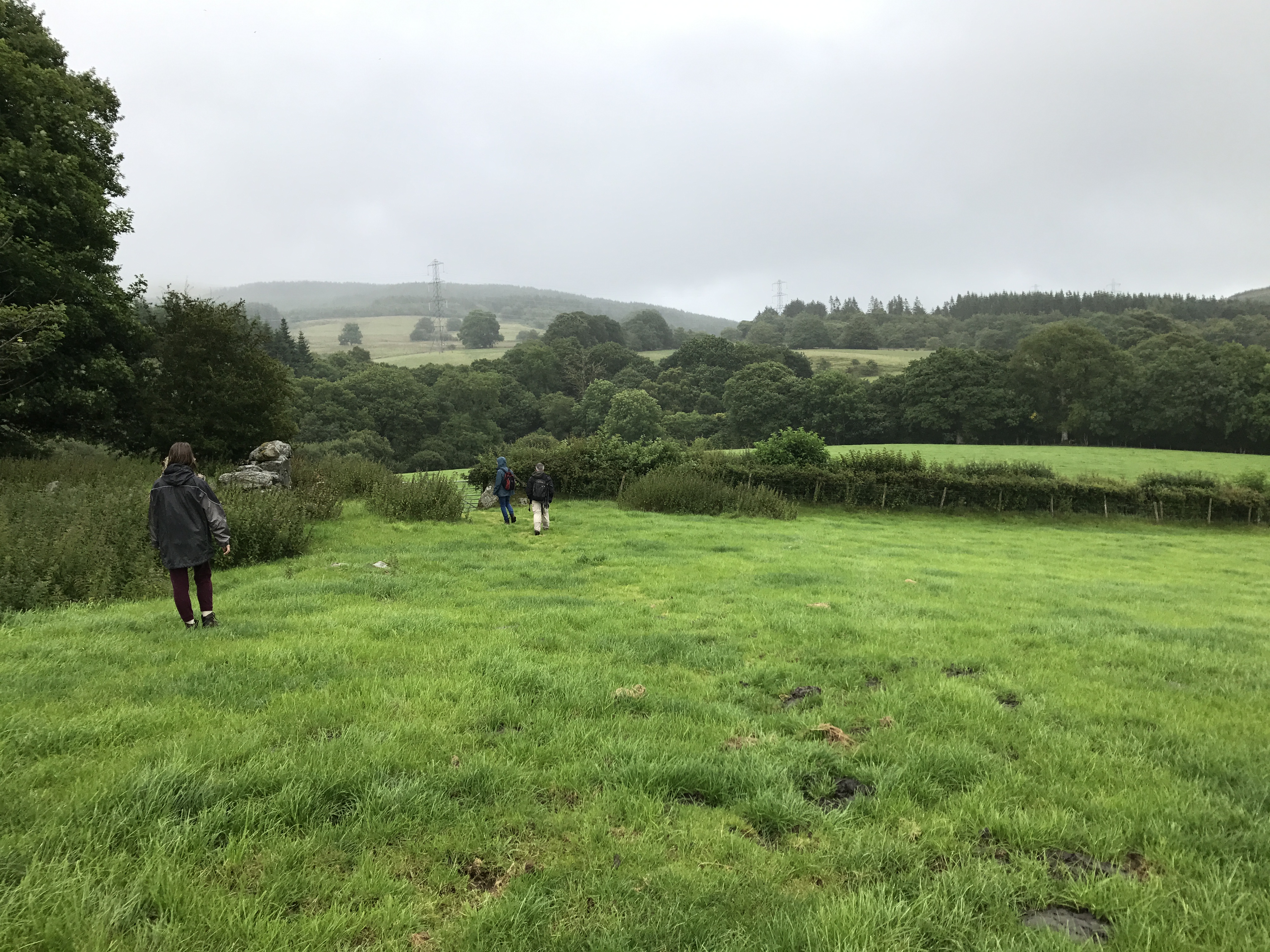
Walk back to the A5, cross the road, and go through the gate on the left from St. Curig’s church, where the walk starts. From the printed out route details, you can’t really miss the path. The path goes through beautiful woodland, green fields, crossing streams, climbing stiles. You have to look out for the path to the left just after passing the big boulder. Here the path climbs up the summit of Crimpiau hill.


You get magnificent views of the surrounding area, 360 degrees around. Make sure not to climb down at the other side but take the path on the higher ridge on the right side of the hill. There are some difficult downhill scrambles and you pass the beautiful little lake Llyn Coryn on your right. After that a few steep downhill paths you rejoin the path at the beginning of the walk just before the woodland. Turn right onto the path and return to the car park.


This is a really gorgeous walk, not too hard, but challenging enough, with a nice summit walk, where you enjoy great views. Nature is abundant everywhere along the way. Heather was in bloom in July, colouring the sides of hills deep purple. The path is not too busy with people, even in summer.


We then skipped walking one day because the weather was really bad. Heavy rain with heavy gusts of wind, cold, misty…. We took a breath of fresh air in the evening with a walk at the beach when suddenly the sun broke through the clouds. The rest of the day we enjoyed chilling around our cottage, giving our body some recuperation time after three days of walking.
2. Cwm Idwal walk from Ogwen cottage near Bethesda
The day after it still rained and there was a lot and the wind making for a very blustery day on the Cambrian coast. In the Northern part of Snowdonia the weather seemed to be a bit better so we decided to go for a walk in Ogwen. One of the reasons we chose this walk was the promise of a walk offering some of the most dramatic mountainous scenery in the UK. The walk goes around the ice sculpted Cwm and Lynn Idwal, with world famous rock formations and rare and fragile plant life. Who could say no to that?


We had to make a detour from Beddgelert because there had been an accident on the road between Beddgelert and Capel Curig. So although we had woken up earlier it still was almost midday when we started our walk. There. There is a parking lot at Ogwen cottage, a few miles South of Bethesda. You have to pay 2,5 pounds for up to 4 hours and 5 pounds for half a day. But you can pay by card, so no scrambling for coins. As in most places parking space is limited. You can download a detailed route description from the website of the National Trust, which is a good help. In any case: the paths are easy to find, but there are no way markers here.


Until somewhere halfway I did not understand why they called the walk challenging. That was before the stream crossing which was indeed a challenge and quite the scramble. But apart from that, the walk is very straightforward, with some climbing and descending rocky parts, but all very feasible. If the climbing and stream scrambling is not your cup of tea you can take the alternative route in the valley on the shore of the lake. There is another higher route that attracts experienced mountain climbers, and used to be the training grounds for many pioneering mountaineers, including Everest conqueror Edmund Hillary and Charles Evans. Cwm Idwal offers something for everyone.


The walk is 4,8 km long, takes a little over 2 hours, is easy or challenging and starts from Ogwen cottage South of Bethesda.


From the car park walk to the visitors centre and climb up the steps at the left side of the centre. Go through the gate and over the wooden bridge, and take the right fork at the junction. (Along the more formal stone paved path). Walk until you reach the lake and go in the clockwise direction on the Eastern lake shore. The large boulders to the left are the Darwin Idwal boulders. A bit further is a gate, after which you come at the junction where you can take the high level route to the left, towards the Idwal slabs and the cliffs above,or continue straight. Only take the higher route if you are an experienced rock climber! The cliffs form what is called ‘The Devil’s Kitchen’. A bit further again you can choose between the easy path that follows the shore or the gradually climbing path to the left. This path is for the most part moderate, except for the difficult stream crossing. Just take your time and hold on tight and you will be fine. After the climb you descend again towards lake level, and finish the tour around the lake.


We had good weather for most of our walk, there where some heavy gusts of wind from time to time, and we had one heavy downpour, but that was it for the bad weather. The website said the walk takes 3 hours but we finished it in two without rushing.


This was the shortest and easiest walk of the whole week in Snowdonia, a bit too short to our taste. We had some spare time and drove to Conwy to see the town and have an afternoon coffee or tea. The village is the most beautiful of all the villages we passed in Snowdonia. The castle is really impressive, and the city centre has been beautifully restored to its old charm. It is very touristy, but that is OK after a whole week spent in nature. You can visit the smallest house in the UK ….. (tourist trap first class). I saw several people walking around with plastic baskets and rope, and wondered what it was for. After having Welsh afternoon tea in the Pen y Bryn, the mystery was solved when reaching the water. Families buy these buckets to go crabbing. With bait (raw bacon) in a small net they try to catch crabs. A very popular activity! The thirteenth century castle built by Edward the first certainly defines the look of Conwy. It was a pleasant visit overall.


3. Scenic Moel Emoel trail in Bala
Our last day started promising so we first wanted to walk in the Rhinogydd area ( area of Rhinog Fawr and Rhinog Fach), just behind Talybont. I had found a circular walk on the website ‘Mud and Routes‘ and a detailed route description and map on the ‘AA’ website, where the walk was named ‘High lakes and Highwaymen’. The walk starts close to Llanbedr, one village further. The walk was about 8,8 km long and would take about 4 hours.
Just when we left our cottage rain started pouring down, not just a drizzle but lots of water coming down, and the mist started to form as well. We realised these wouldn’t be the best conditions to venture out on a walk that was hard to find and not way marked at all. We did not have a detailed map of the area either and would have to do with the route description I had found online. I quickly looked where in Snowdonia we would possibly have better weather. The closest area with slightly better weather was Bala, a 50 min. drive away. We decided to try it, the other option was to return to the cottage and stay inside for the rest if the day. Worst case scenario would be that the weather in Bala was so bad we would only have a coffee and come back. But at least we would have tried.
The weather seemed to improve when we got closer to Bala. In Bala we followed the sign to the Gorwelion visitors centre. This seems the be the new name for the older and closed down Canolfan Cywain centre. There is a car park and inside the centre you can eat and drink. There is a shop where you can find leaflets explaining the different walks in and around Bala. Just what we were looking for. From the different leaflets only a few walks started at the visitors centre and only one was a circular walk. (Moel Emoel trail, T9)


The Moel Emoel trail (T9) circular walk is almost 12 km long and would take between 4 and 5 hours which was a bit long considering that the weather in Bala did not look very good. It starts at the Gorwelion visitors’ centre in Bala and is a moderate and scenic walk. It climbs to the top of Moel Emoel (549 m), and goes over farmland, moorland and some minor road sections. You have views of Bala and its lake and the surrounding mountains.


It had started to rain in Bala too, not too hard, more like a drizzle at the start. We decided to just start the walk and if the weather deteriorated too much we could always return. I also noticed that after about 2/3 down the first half of the walk you could take a short-cut and join the second half of the walk at also about 2/3 of the second half. This way we could always shorten the walk if needed. The leaflet has a good detailed map and a detailed route description. I figured this should be enough and we would not have to buy an extra map. There are way markers on the path, but not everywhere. The leaflet is clearly outdated. Along the way farmers have put up new fences and gates, sometimes removing gates and signs, and sometimes putting fences where there didn’t used to be a fence. The path had not seen many walkers for some time. It was overgrown in some places and had become invisible in other places.


Especially between point 4, where you cross a small forest area and point 6 where you pass two buildings (Penmaen-canol). Here we lost quite some time trying to find the right path. There was not any obvious path through the field and we did not see any way markers up until just before the two buildings. We lost our way and we walked pure on direction, using the details on the map en the compass on our mobile phone. We rejoined the path just before reaching the two buildings. Once past point 6 the path was easier to find, but we still checked the map, read the route descriptions and looked at the arrows on the way markers.


Between point 7 and 8, there were the path turns sharply left along the fence, we went straight and followed the short-cut path to join the return path at number 16. We did not climb to the top of Moel Emoel ( 549m) which was completely in the mist, while the rain intensified. We had walked two hours up to that point and figured it might take another two hours to get back. We were getting cold and wet and needed some warmth and a warm drink. During most of the walk the ground was very wet, and in some places marshy, but our waterproof walking boots did the trick.


The short-cut easily brings you to number 16, and from there the path is rather well way marked, well enough to not loose your way again. By the time we got to the centre and our car, it really started to rain quite hard so we were happy to have reached the end. The walk had taken 3,5 hours, I guess without using the short-cut it takes 4,5 hours. And even though the weather had been very Welsh, we had enjoyed our walk. Having to search for the way had given some extra ‘pun’ to the otherwise rather bland walk. This was the simplest walk of the week, no real climbing involved, but the weather and the bad markings had made this walk more challenging and actually just right for this day! End good!


What to pack for a day walk:
Coins to pay your parking ticket (5 pounds)
Enough drinking water
Snacks (cookies, muesli bars, dried fruit and nuts, fresh fruit, dried sausage)
A fleece sweater
A raincoat (and poncho or waterproof trousers)
Rain protection for your backpack
A first aid kit
Wear decent waterproof walking/hiking shoes/boots
A map, your mobile phone ( with a compass and flashlight on it)
A hat and sunglasses
Sunscreen
Gloves (especially outside of summer)
Passport and insurance card
Camera
