February 15, 2022


During our trip of 2,5 weeks in Norway in October in 2021, we alternated the days in the car with day hikes. Since we had eliminated Stavanger from our itinerary that meant we couldn’t hike to the Preikestolen and we did not have enough time for the Trolltunga hike especially since we came rather late in the season and the weather might prevent us from undertaking these popular hikes. Each of the hikes below can easily be done in a day and some even in half a day. We aren’t the fastest hikers since we usually make several stops to take photographs and enjoy the views.
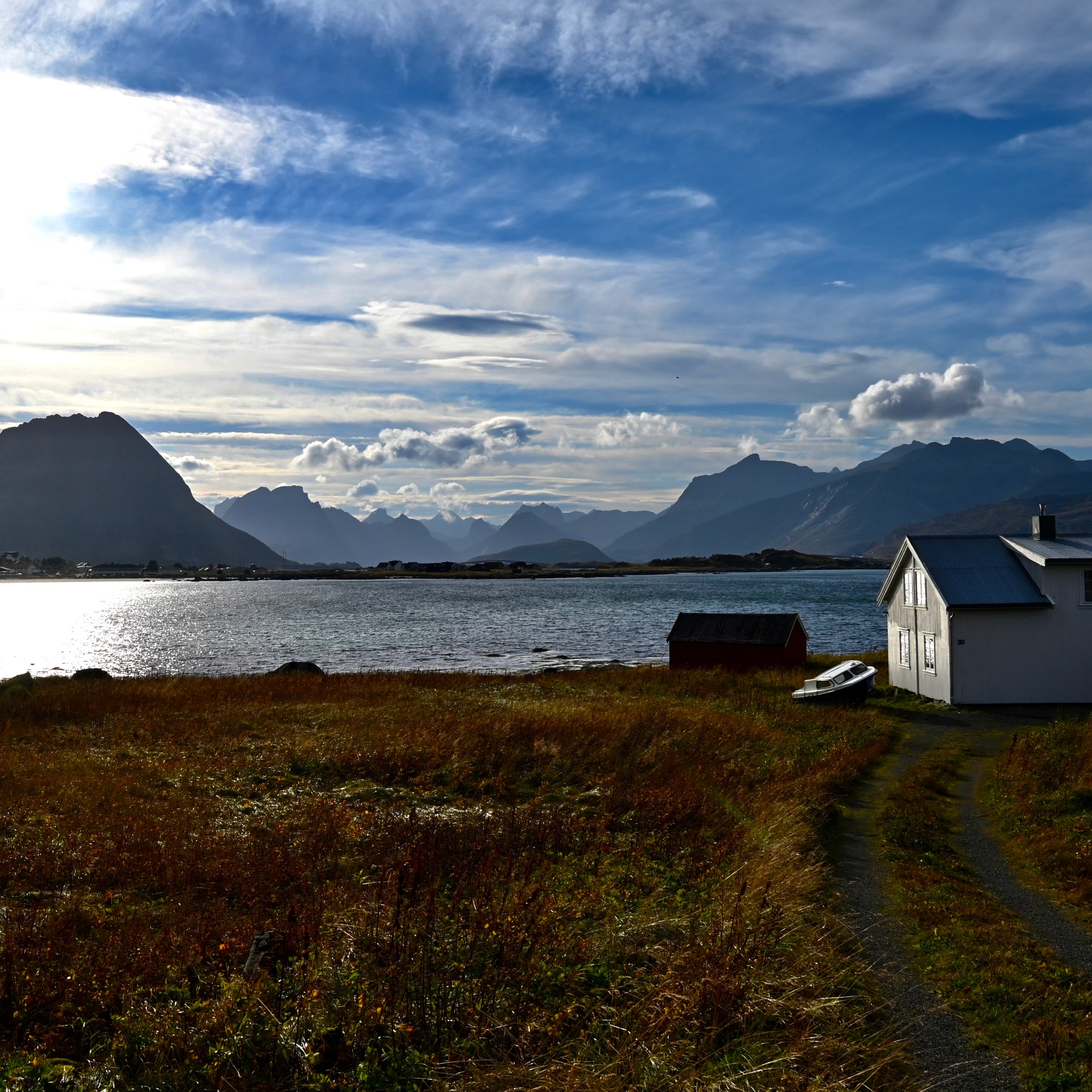
1. Festvågtind hike. The first five days we stayed on Vesteralen and Lofoten. After a stop in Andenes for a whale watching trip we drove on to Lofoten and arrived after sunset in Svolvaer where we had booked a room for three nights in the Scandic hotel. The hotel is a little dated but in good shape, with a friendly reception. The rooms are very small but clean and we had a small balcony overlooking the water. The hotel offers free tea and coffee all day and a fruit bowl in the lobby. The breakfast is very diversified with enough choice with a warm and cold buffet, fruit, yoghurt, muesli, different kinds of bread and pastries, and a gluten free corner. On our first night we had dinner in the Bacalao restaurant, mussels with fries and a vegetarian burger, both really tasty. The restaurant is nicely decorated, and just a 2 minute walk from the hotel. The first morning we took our time to get up and have a leisurely breakfast.
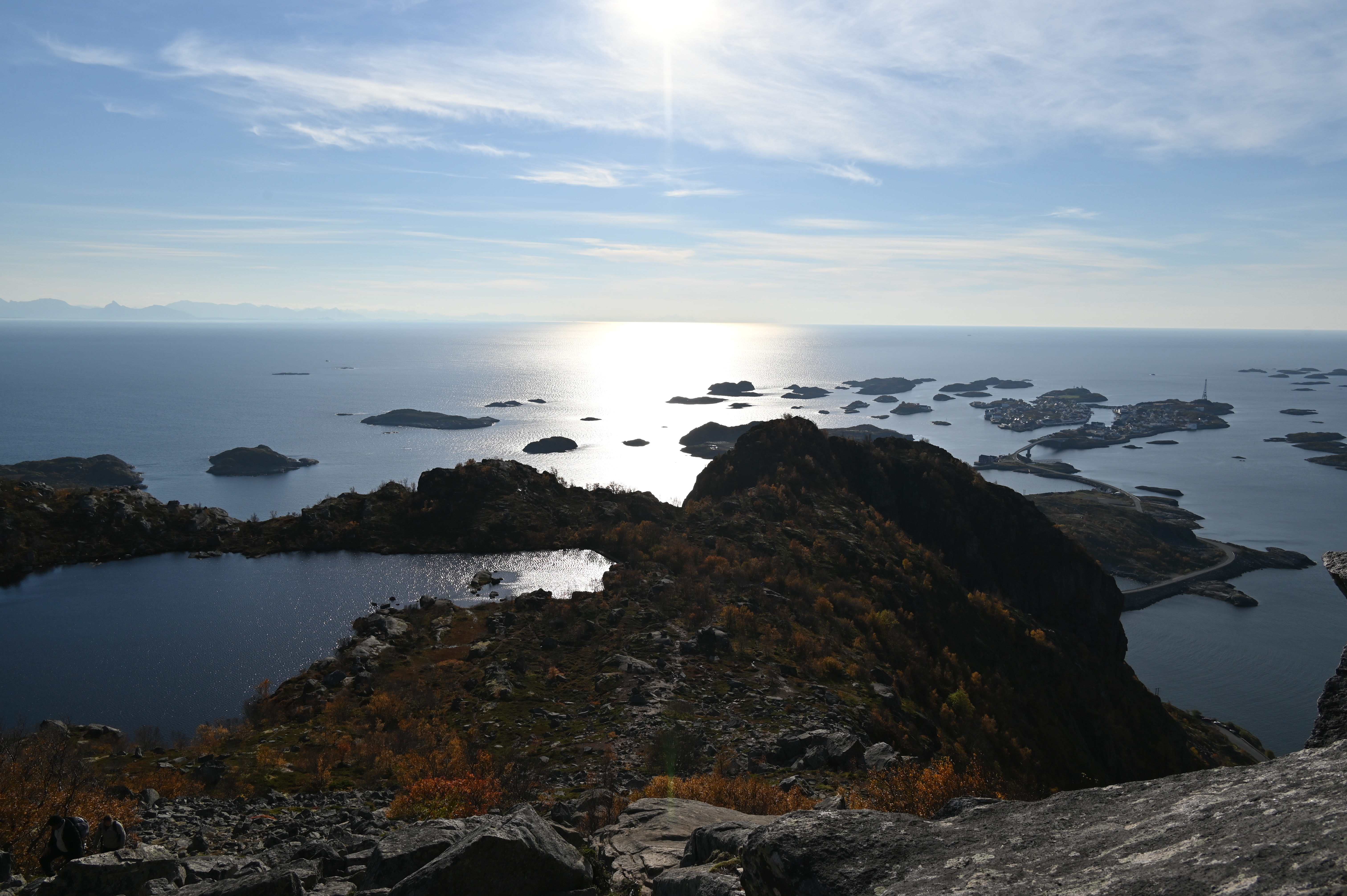
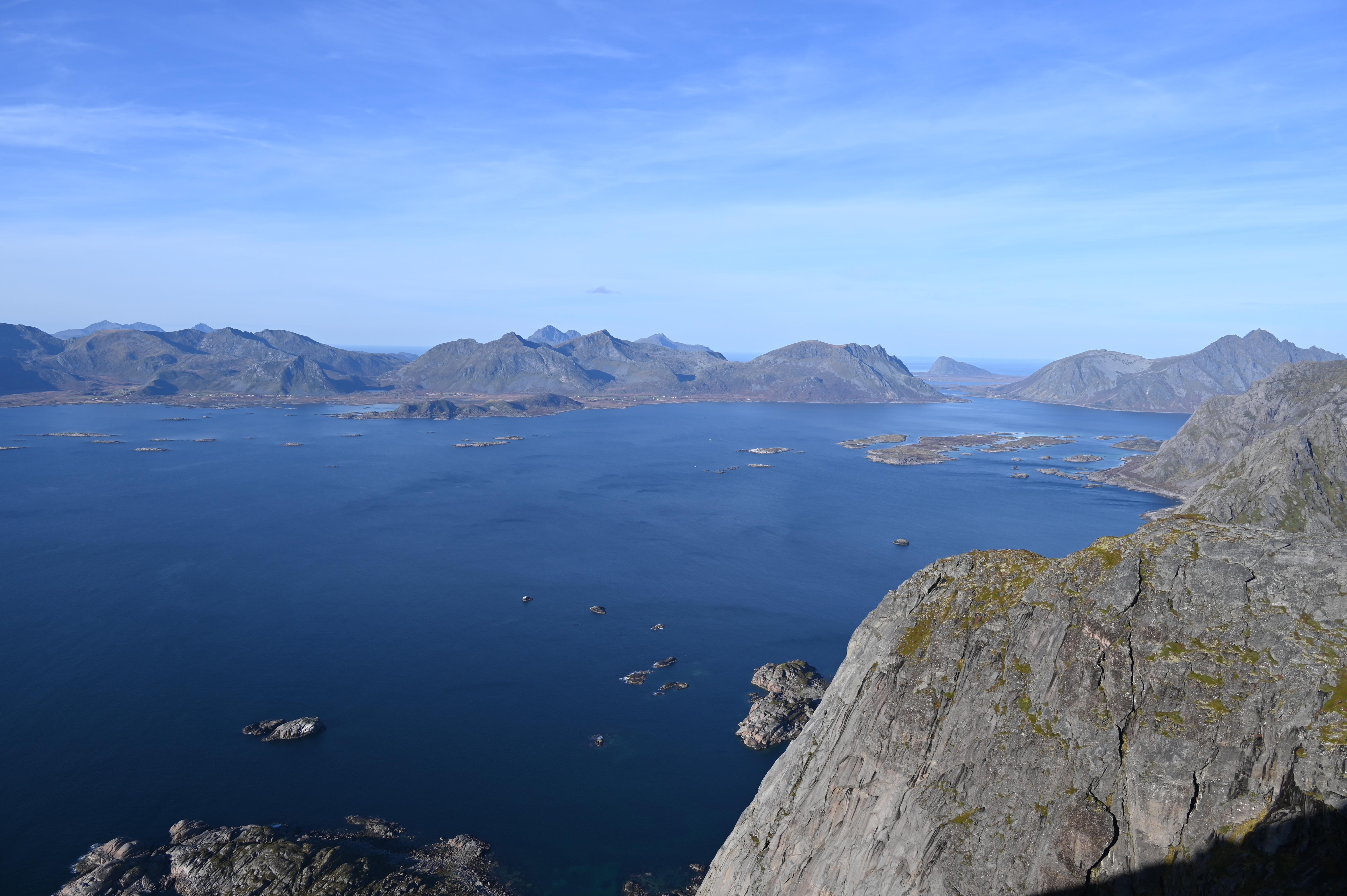
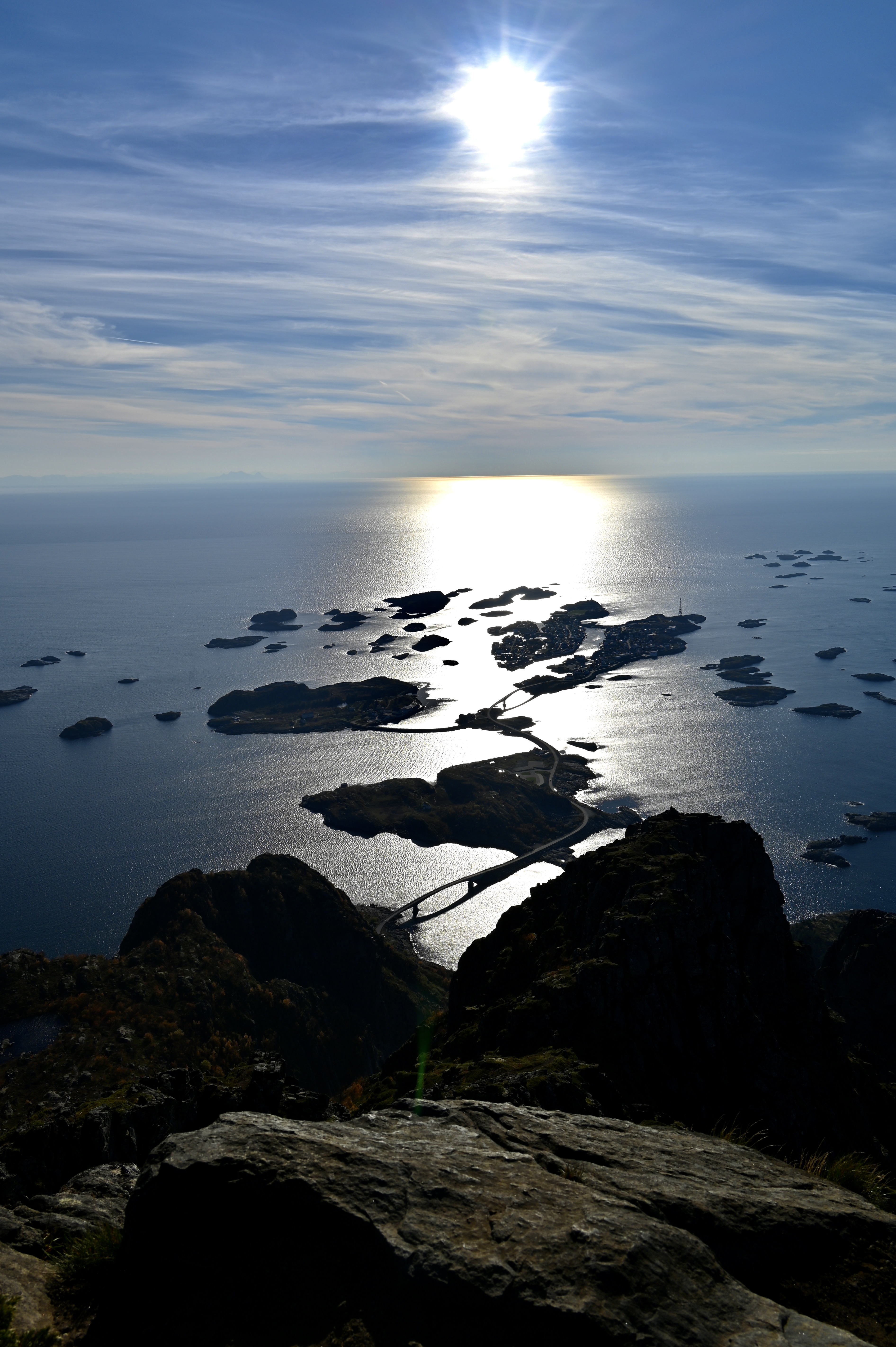
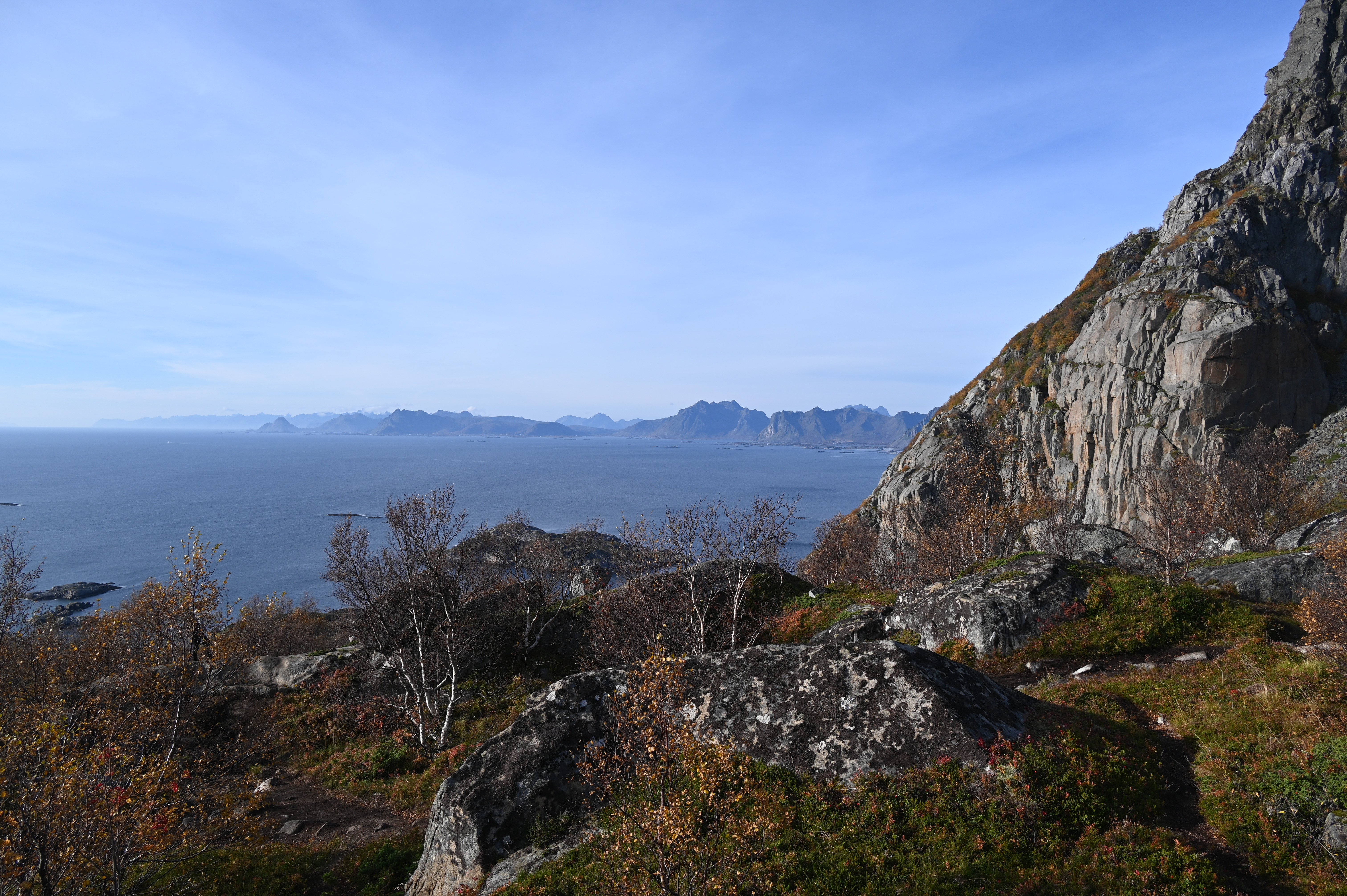
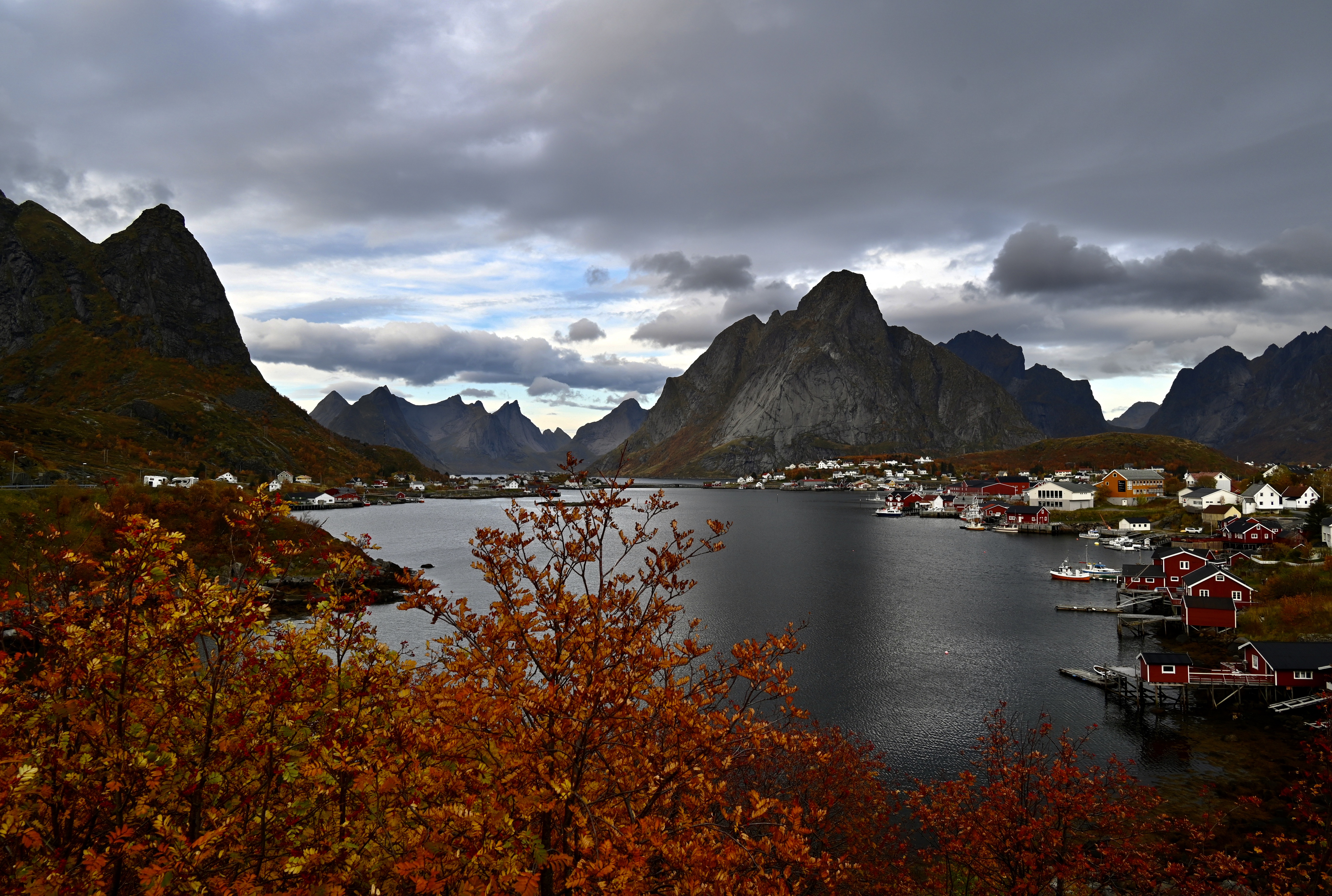
We left the hotel around 11 AM and drove to Herringvaer, where we parked our car just after the second bridge before you reach Herringvaer. There is a parking area just before the first bridge, where you have to pay. The parking area just after the second bridge is small pullout, only a few cars can park here, but since it was low season, we could park our car here for free. You then have to walk back towards the start of the trail in the bend of the road. Our plan was to hike up the Festvågtind, a stunning hike that rises directly from the sea near Henningsvær. The summit is 541 m high, the hike 3 km long and quite steep and the vertical gain of the hike is also 541 m since you start at sea level. It is easily one of the most popular hikes in Lofoten. From the summit you are rewarded with breathtaking views to the south over the town of Henningsvær and the surrounding islands. The start of the hike was not very well signed, but we found it when we saw others coming down. The trail starts on the right side of an old stone water tank in a bush of small trees. The first part of the hike going up is not always well marked. You have to scramble over a field of boulders after which the the little path is easier to follow. The walk could do with a little more signs. We started the hike around 12 AM and came back down 3,5 hours later. Halfway you reach lake Heiavatnet, which was once the ancient drinking reservoir of Henningsvær, where people love to swim in summer. Before you reach the lake the track veers sharply to the left in the direction of the peak to get close to the cliffs. You have to climb an area after which the trail begins to head more and more to the right (North) to avoid the cliffs while the small lake begins to appear below you. The trail sometimes climbs very steeply, but it never involves rock climbing. We took our time to take pictures on the way to and from the top, where we had lunch with a stunning view. We had beautiful sunny weather, and thus had a great view from the top. We were not the only ones doing the hike that day, but I was happy to do the hike at the end of September, it was not very busy, we met just a few other small groups. I guess in summer you probably have to stand in line to climb to top to enjoy the view. Since it was already 4 PM when we arrived back at the car, we decided to drive back in the direction of the hotel. We had our dinner at the Nordis restaurant of the Lofoten Suite hotel. We saw the Hurtigrutten arrive and many tourists flocking to the different restaurants, and were happy to have ordered before they arrived. We both had a pizza, and especially the vegetarian pizza was really good.

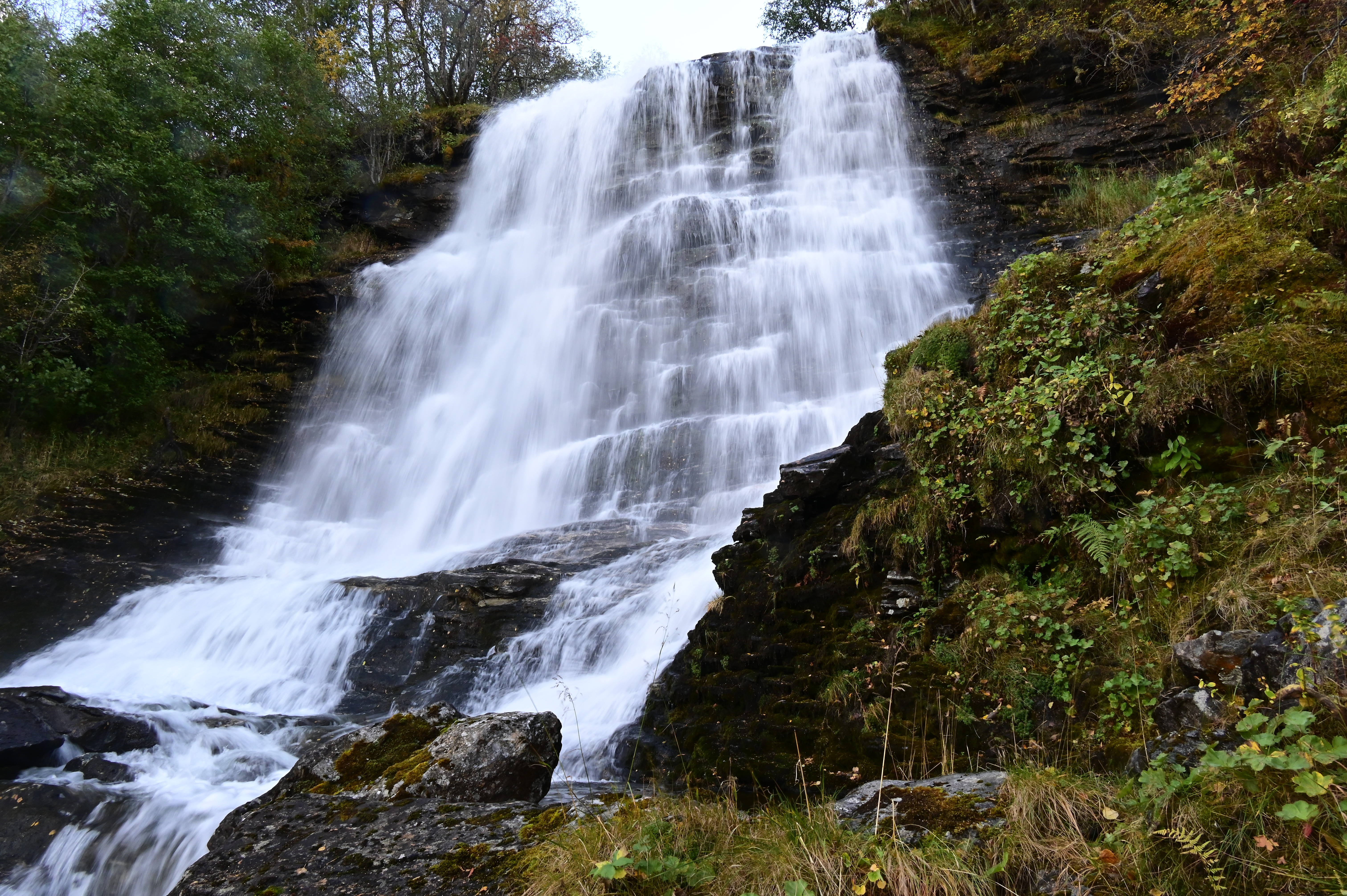
2. Storsæterfossen waterfall. In Geiranger we spoiled ourselves and stayed at the fancy Union Hotel. In Geiranger we made a walk up to the Storsæterfossen waterfall. We parked our car at Vesterås farm above the town of s and started the hike. We walked up the gravel road and found a turn on the right that leads up to lower parts of the waterfall. Unfortunately the way to the waterfall was not well signed and we never made it to the top which was a pity because there is a secured pathway that goes behind the waterfall… The hike can do with some better signs!! To find the right path you have to back track on the gravel road until you pass cabins located on the left hand, where a tractor road takes off that leads up through hayfields. Follow the tractor road until you reach a gate at the forest edge. You will pass through the gate and come onto a stone pathway with hundreds of steps made by sherpas from Nepal and completed in 2014. Eventually you can walk behind the top of the waterfall, which we missed but we enjoyed the walk and the view of the Geiranger fjord anyway.

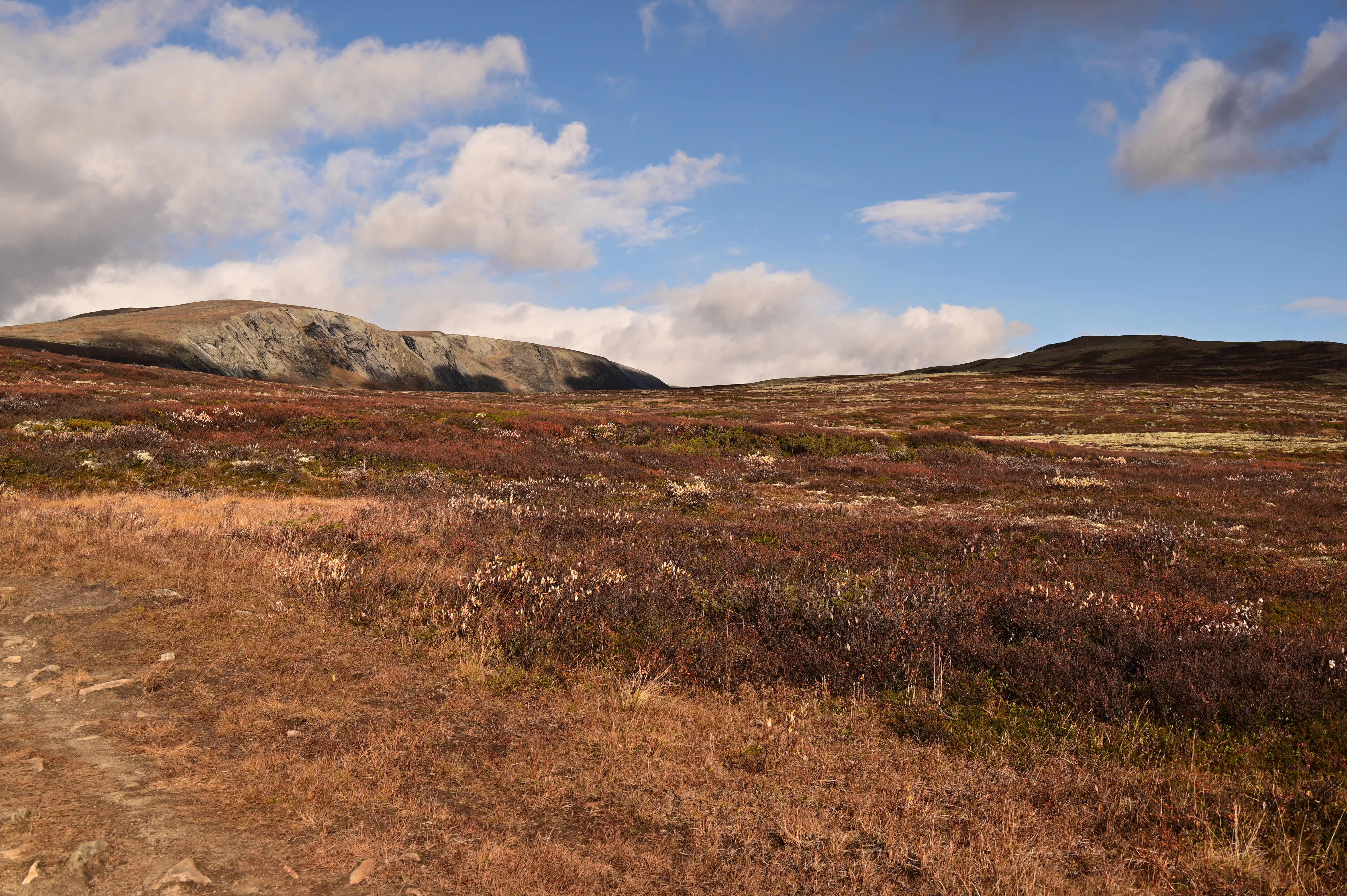
3. Dovrefjell-Sunndalsfjella National Park. From Geiranger we drove to Dombas where we stayed at the Dombas hotel. The hotel has a sauna for its guests and the rooms are made up, something we missed in the Scandic hotel in Svolvaer. You can take free coffee and tea during the day, a service we had in every hotel in Norway. After breakfast we drove out to the de Dovrefjell-Sunndalsfjella National Park because we wanted to spot the Musk Oxen that live there. Musk oxen originally come from Alaska, Arctic Canada and Greenland. The oxen used to live in this area more than 30,000 years ago before the last ice age but became completely extinct in Norway. They have been reintroduced from Greenland in this National Park in 1953. They had been introduced before in the 1930’s but hunted down to extinction again. You can book a musk oxen tour but you just can as we did make a hike in the park and look for the oxen all by yourself. I read some blogs of people who did just that, and with those tips it is totally feasible to go out by yourself. Driving towards Kongsvold Fjeldstue, we first made a stop at Snøhetta parking, and from there walked the 1,5 km (20 min.) up to Snøhetta viewpoint, where they have built a beautiful pavillion where you can make a fire and enjoy the view across the National park, a place where reindeer roam. The pavilion was named “World Building of the Year” in 2011.
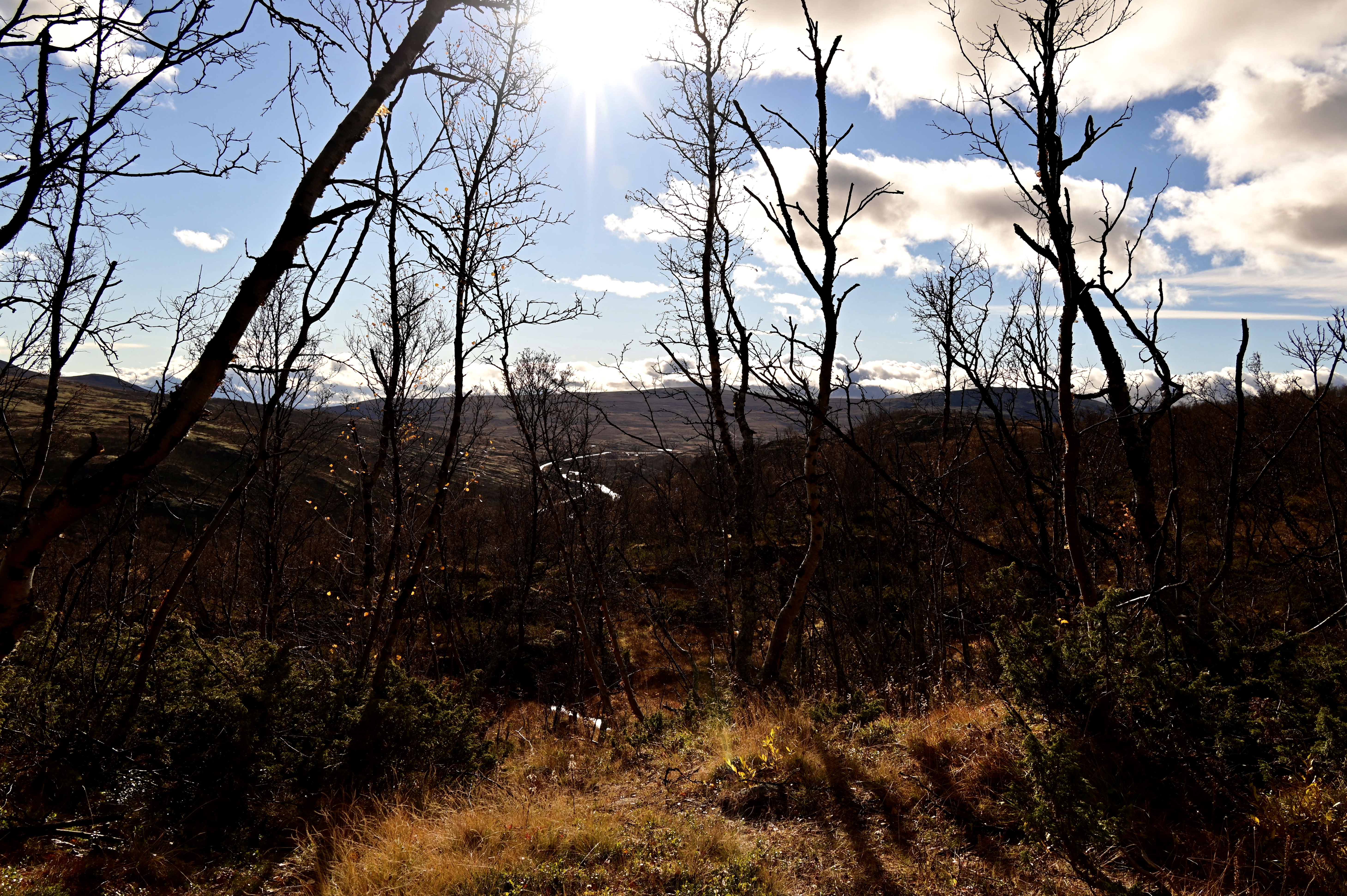

We continued towards Kongsvold Fjeldstue, a historic hotel where we parked and departed for our oxen safari. It was a great day, the weather was quite chilly and windy but sunny. Just before you reach the hotel, there is a sign on the left side of the road that marks the start of a trail into the National Park. You walk across the valley, under the train rails, and into a birch forest. You slowly gain altitude and a short walk later you reach a kind of plateau.

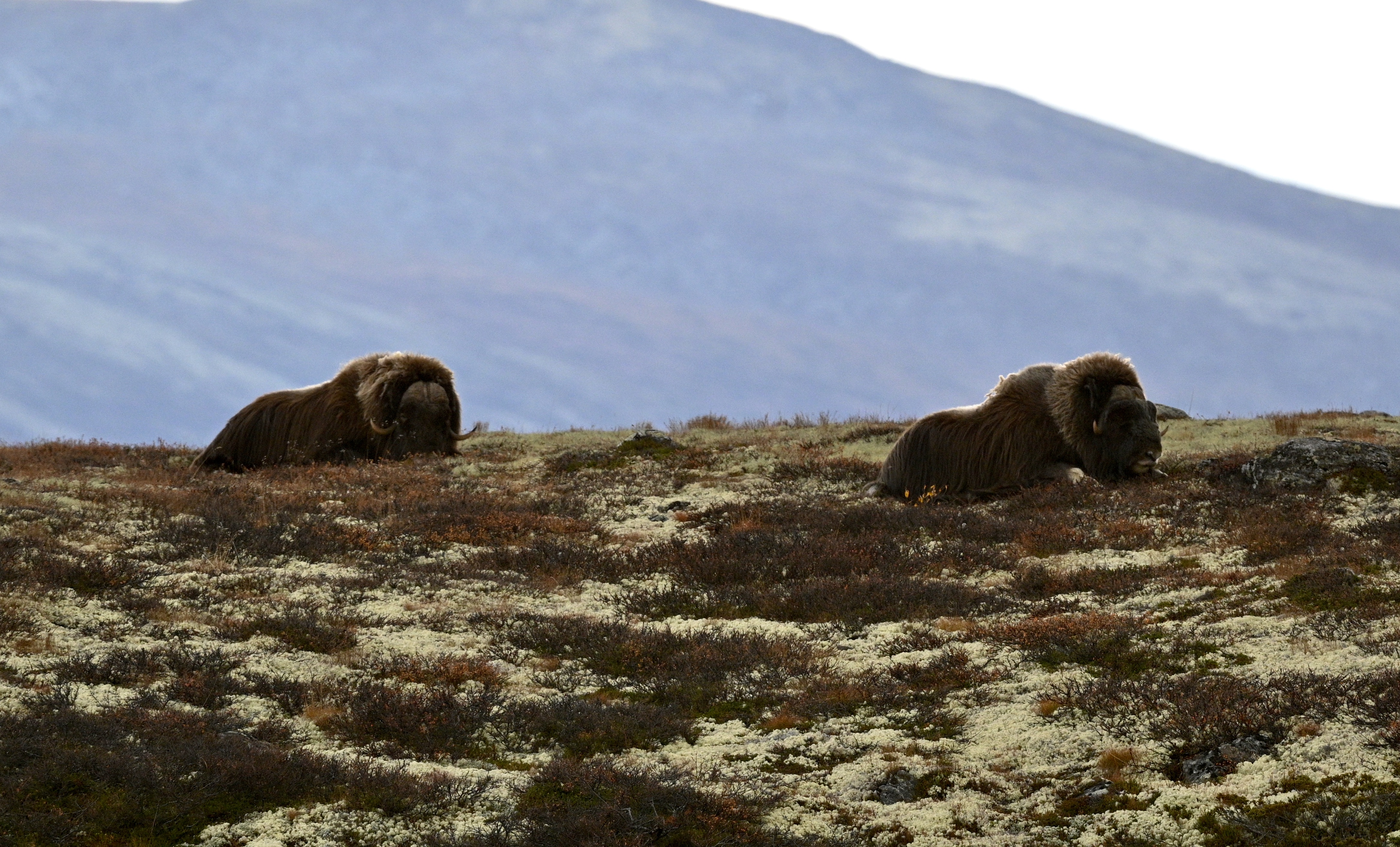
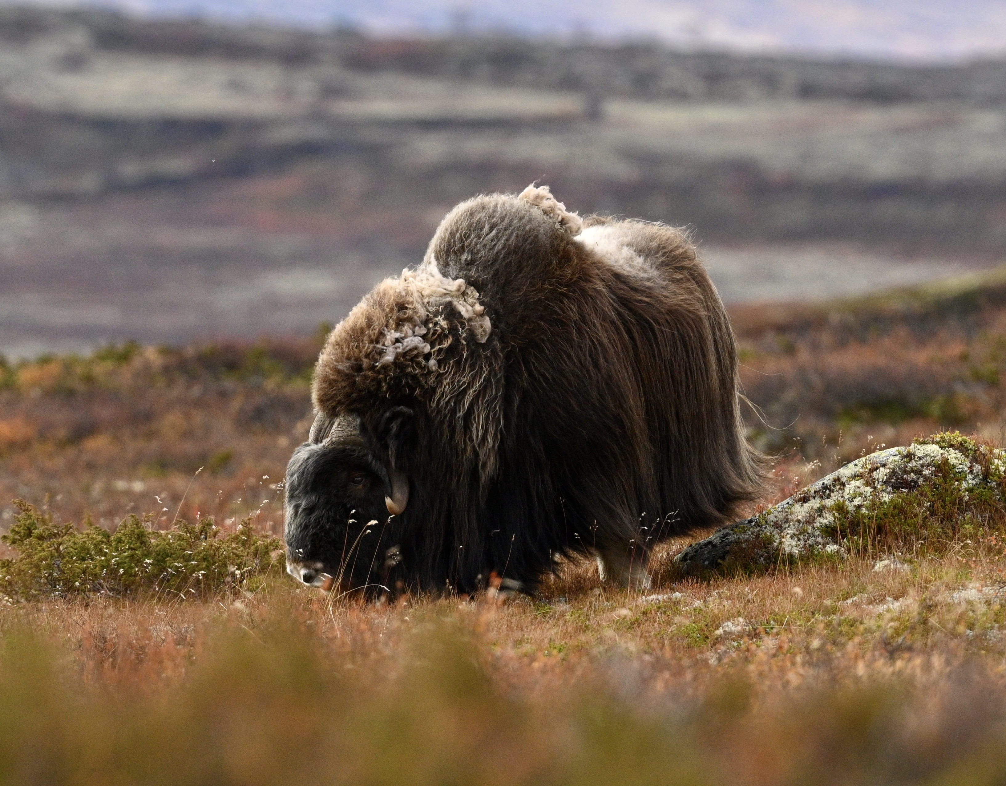
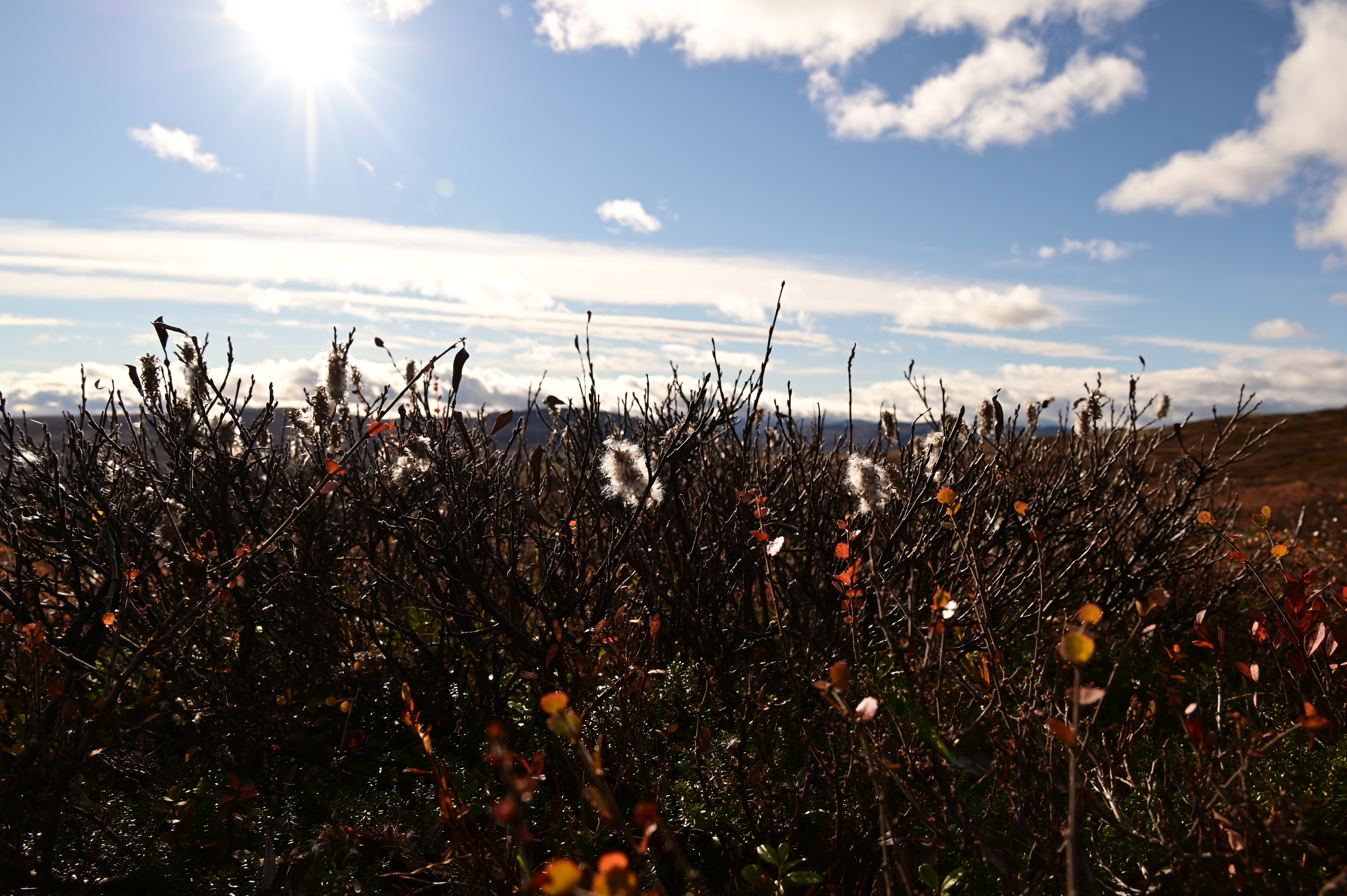
Very soon we saw several oxen and we could even approach them till about 200 m distance, the distance that is recommended to make sure they do not attack you. Other small groups were also observing the oxen. If you go out on your own, you will often find the oxen by just observing organised groups. But it is also very rewarding to find them all on your own! We saw some 12 musk oxen in total, some from quite close, others further away and at the end of the day we saw two oxen lying down and having a rest, just on the rim of a little hill with the evening sun in the back, just wonderful! Funny thing is, with the autumn colours it is not always easy to spot the oxen who are perfectly camouflaged this time of year. Often they first look like a big rock from afar, and only when you get closer you suddenly see the rock is actually an animal. They move quite slowly, grazing all the time, and even if you think they haven’t seen you, they keep a close eye on you! The plant vegetation forms a specific ecosystem with small plants like lichen and mosses and alpine flowers that have adapted to the harsh conditions of the plateau. We made great pictures, and the park itself is a beautiful place to make a walk, especially when it is dressed up in autumn colours. The weather was partly sunny, partly overcast, but no rain or fog! It was a tiring but perfect day. Dress warmly because it can become chilly on the plateau!


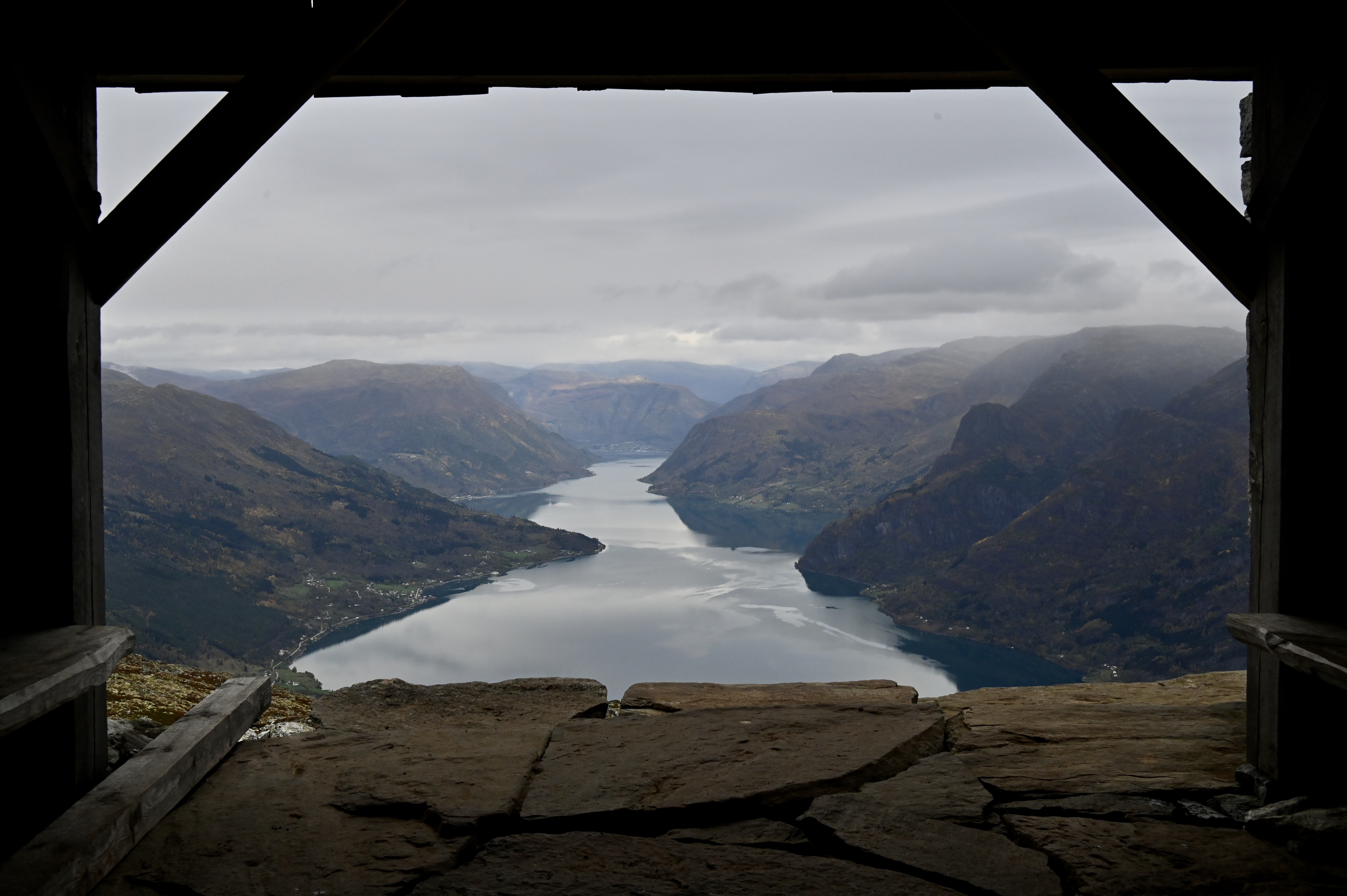
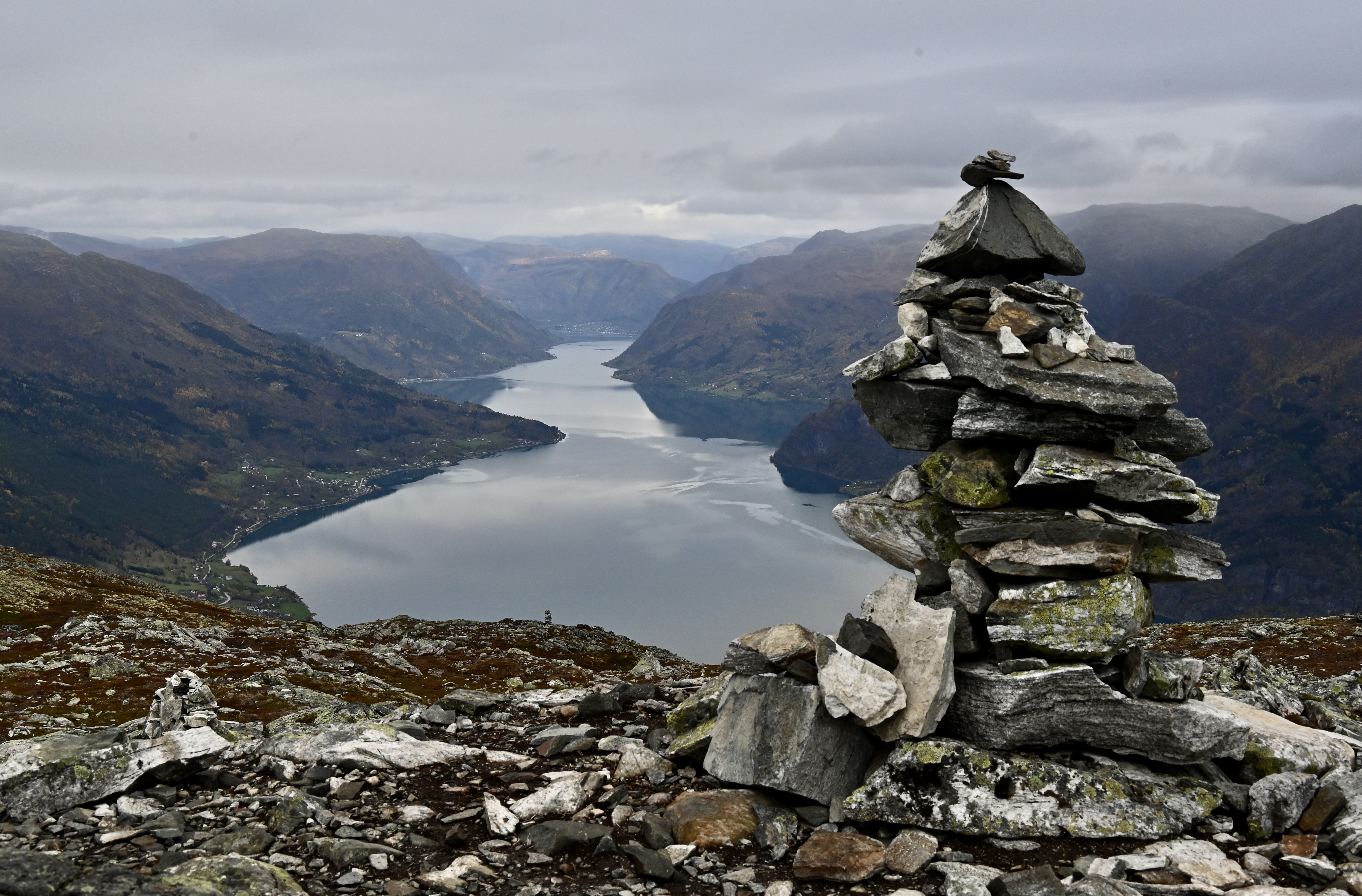

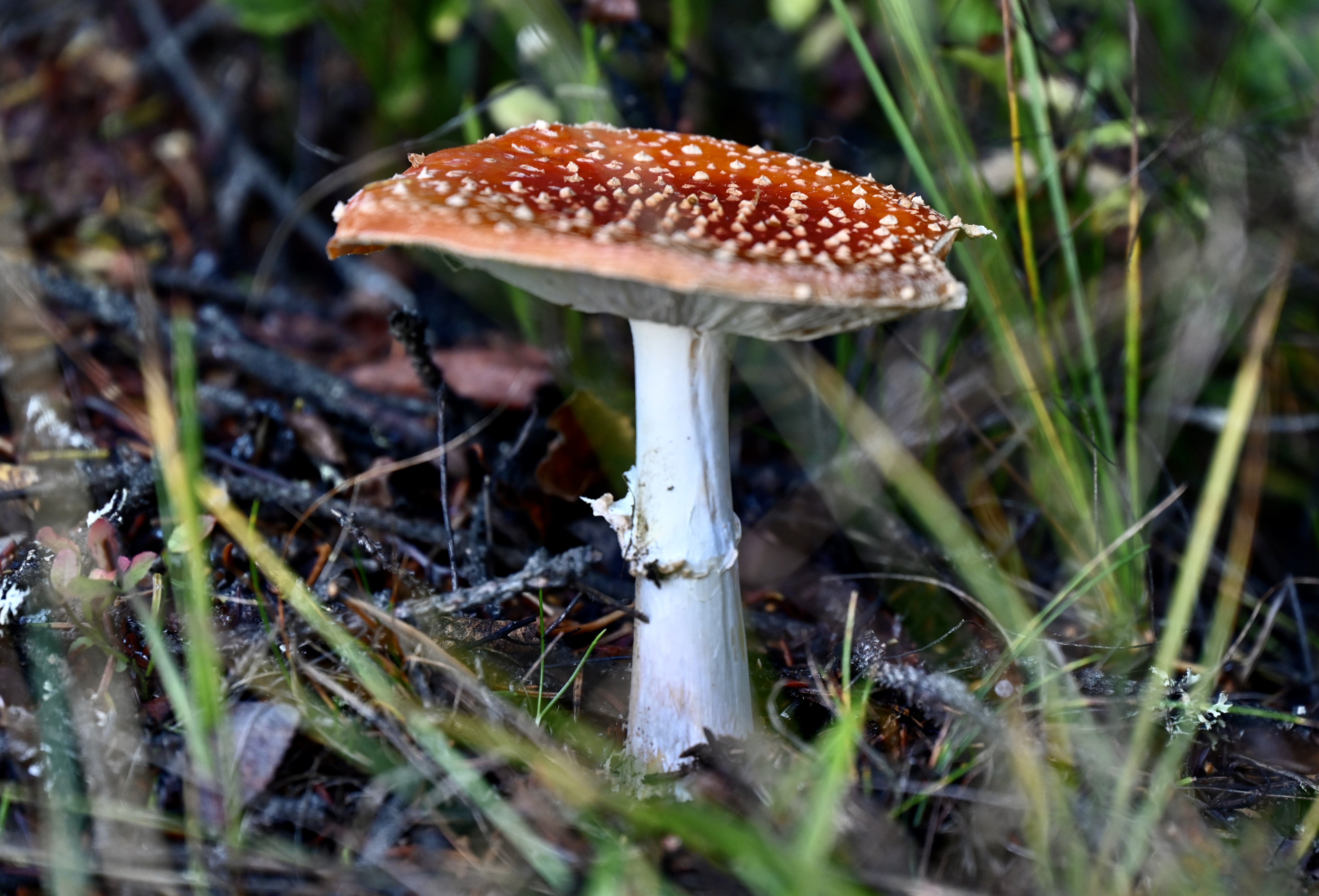
4. Mount Molden. In Sogndal we stayed at the Best Western hotel. The hotel has for Norway standards very large rooms. You have to pay for the parking during the day, but it is free of charge at night. We had planned to hike up mount Molden, a four hour walk with an elevation of 600 m till the top of mount Molden at 1118 m height. We drove in the direction of Hafslo and Mollandsmarki to the Krossen parking lot, some 2,5 km after the junction between the road from Hafslo and the road to Mollandsmarki, where we would start the hike up to the top of mount Molden. We started our hike around 10:30 AM and returned around 3:30 – 4 PM, longer than most people who do the hike in 4 hours, but we made a lot of stops to make photographs, not only of the surrounding landscape, but also of the plants, like the many mushrooms. The start of the hike is very well marked from the parking, it starts at the left side, and climbs up through a forest area, further on several parts have wooden walking planks and stone stair steps. You then reach the treeline and a first plateau with a beautiful view of the Lustrafjord. If you climb higher you reach the Svarthiller farm where you can write down your name, date of visit and country of origin down in the logbook you find in the postal box of the farm. The last third of the hike becomes increasingly rugged, rocky and barren and it is a steep climb up to the top from where you have great views of the Sognefjord, the Lustrafjord, Urnes and all the way up to Skjolden if the weather is clear enough. In the other direction you can see the Jostendalbreen glacier. It can get very cold and windy up here, so we took our lunch in the little farm house where you have a great view over the Sognefjord and where you can sit sheltered from the wind. Don’t forget to climb up to the antenna, where you see the two arms of the fjord at the same time. You then take the same way back down. This hike is less known to tourists but loved by Norwegians.


5. Nigardsbreen glacier. The day after hiking Mount Molden, we drove up to Nigardsbreen glacier. There was quite some fog which lay in beautiful layers around the mountains. The Breheimsenteret (visitor’s centre) was already closed since October first, but the door was open and they let me use the toilet. We drove our car via the tollroad which costs 80 Kr and which you can pay by credit card up to the parking lot next to the lake. From the car park it is a 3 km walk up to the viewpoint close to the glacier. The path is very well marked but quite strenuous, you walk over the polished rocks which can be slippery, so you better make sure you wear shoes with extra good grip. On certain points wooden ladders help you over some higher rocks. Be careful when it rains, it can become very slippery. You also have to cross some small streams where well placed rocks help you keep you feet dry. The walk from the car park to the viewpoint takes about one hour one way. In summer time there is a boat that takes you from the car park to the end of the lake, but it did not go out anymore in October.

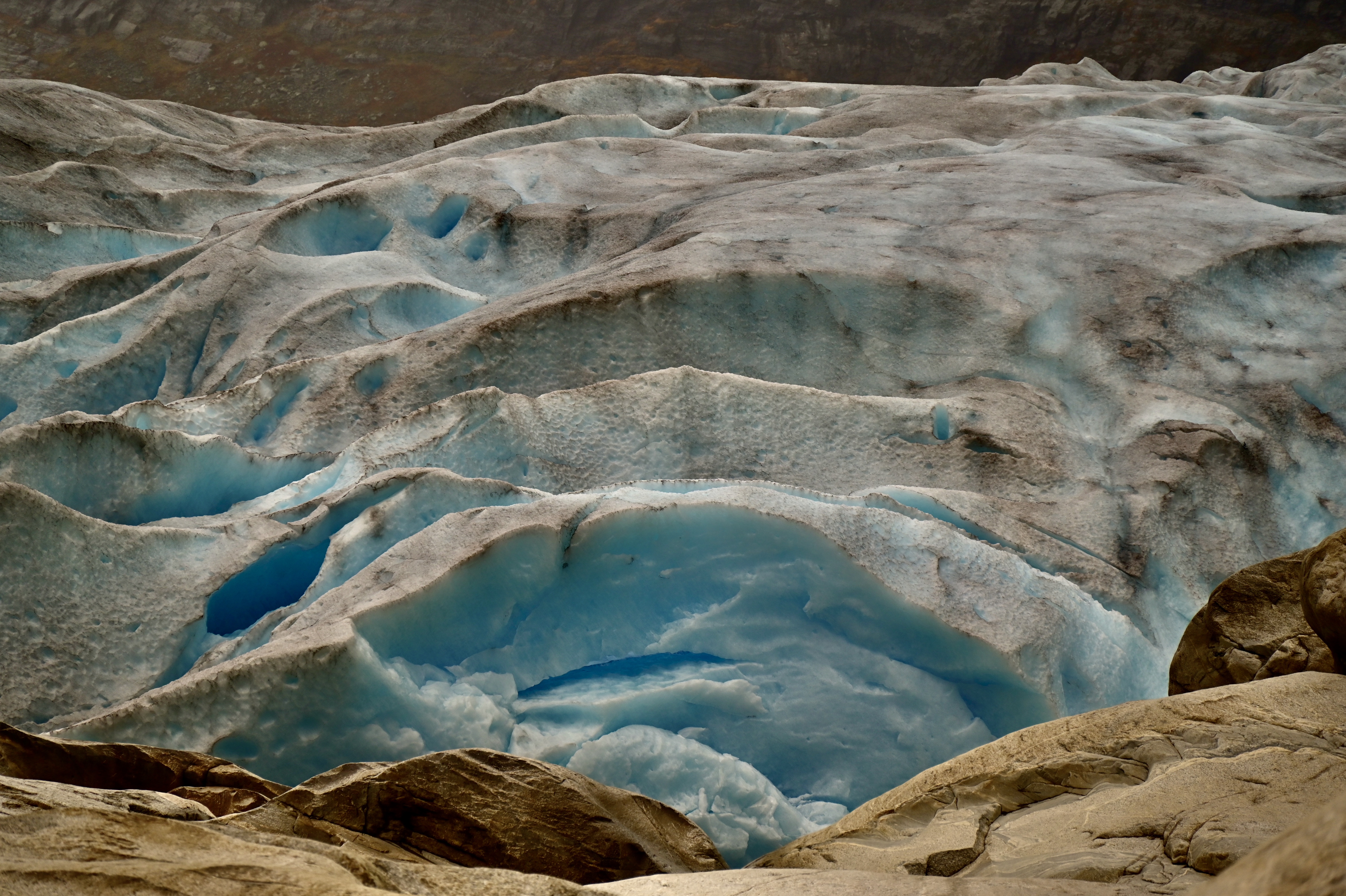
The glacier is closer to the lake at the beginning of the season in June, but retreats during summer, and also becomes darker on top, which makes it a bit less attractive. Still it is quite impressive especially if you realise that our grandchildren will probably not see it anymore. Be aware of the danger of a glacier, there is always the possibility that a part of the ice breaks off, so better stay far enough from the glacier river. We had our lunch close to the viewpoint, before walking back to the car park. We decided to drive to the other side of the Jostedalsbreen glacier, in the direction of Fjærland, to see another arm of the glacier, the Boyabreen. Just before you reach the Boyabreen arm, you can visit the Norsk Bremuseum or glacier museum. We were too late, it closes already at 4 PM in October. We continued a bit further and turned right into the car park. From the car park you walk 600 m to the glacial lake above which the glacier towers impressively.


6. Lilletop. From the Quality Hotel Voringfossen in Eidfjord we drove to Tyssedal and Skjeggedal where many start the hike to Trolltunga. Since it was already late in the season and the days were getting shorter, we decided against hiking the Trolltunga. We came for the short hike to Lilletop. We only started our walk after lunch because of the weather, so our time was limited. The climb itself starts about 1,1 km past parking 1, on the tollroad towards where most hikers park for Trolltunga, on parking 2 or 3. The tollroad costs 200 krone and the parking 2 and 3 cost 500 krone, a hefty cost before you can start hiking to Trolltunga. We eventually parked our car in front of the hostel, which was closed, in the centre of town , since you have to pay for parking 1. We walked up to the tollroad and followed the road until the second hairpin that turns to the right where a sign is put next to a guestparking. Here you can park your car for a few hours. We could have in fact driven up to the guestparking since the toll only has to be paid at parking 2 . There is place for three or four cars here. From here a steep climb, in places with wooden or rocky stairs, brings you in about 40 min. all the way up to the guardhouse of the hydropower plant used for generating electricity that started around 1900. From 1915-1923 the dam guard lived in Lilletopp with his family. The children went to school in Tyssedal every day using this same track, without skipping school once. Here you have a magnificent view over the Sørfjorden, part of Hardangerfjord and the Folgefonn glacier. It rained a bit when we started our walk but while climbing up we had sunshine. Apart from one other couple we were completely alone on the hike. It is probably a lot busier in summer since the guard house opens as a cafe then. By the time we came back down and were almost at our car it started raining lightly. The whole hike takes about 2 hours and is a pleasant climb.
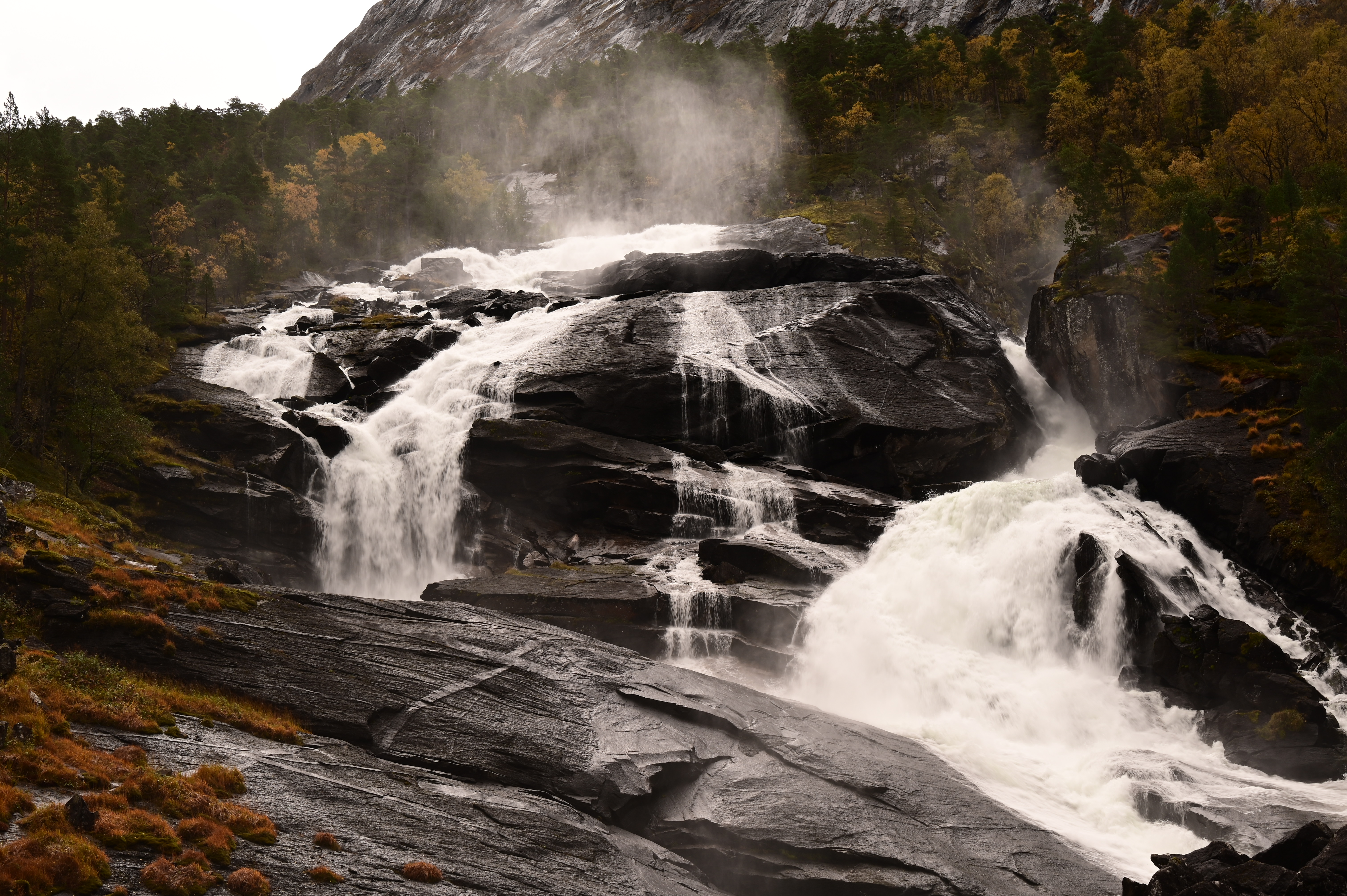

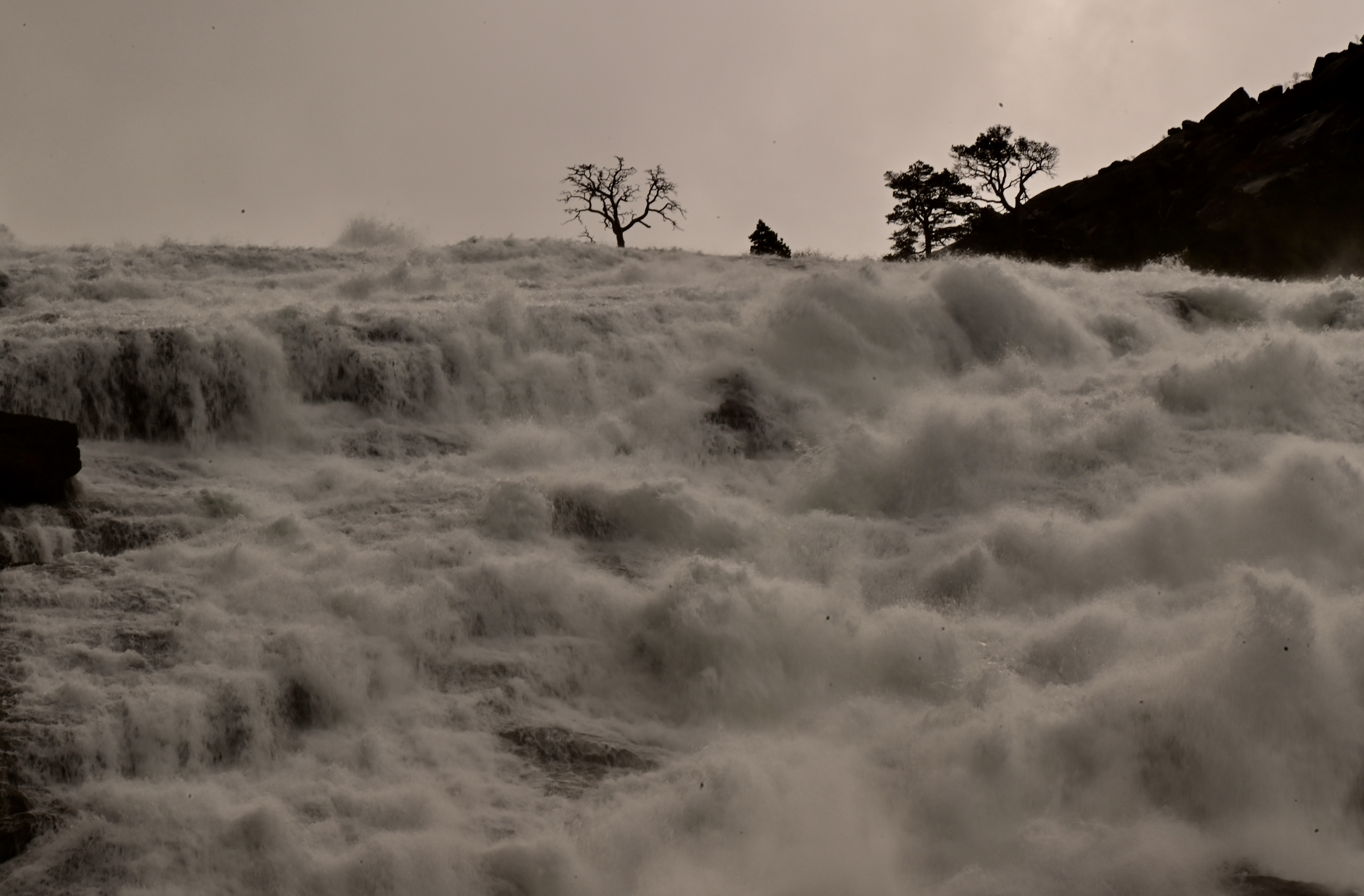

7. Husendalen valley. From Eidfjord we drove out to Kinsarvik from where we wanted to hike the four waterfalls of the Husendalen valley. It was already almost midday when we started our hike. It still rained a little when we started but soon after it was dry. We parked at the car park just before the little bridge. From there we started our hike. You first pass a helipad on the right, and then walk beside the Kinso river until you reach the power station, where the first waterfall, the Tveitafossen comes down right next to the old power plant. From here you have two ways to hike up, the first one is a wide gravel road that starts a little before you reach the power plant, on the left side of the road. The other one is to climb up the steep path that is just next to the big pipes. This hike is marked with red T’s, and starts off just left of the power plant and joins the pipe just after the building. You follow the pipe on the left side till you reach the dam. If you have taken the gravel path you can join the T marked path at the height of the dam. The T marked path is sometimes a scramble and can be slippery after rain, but it leads you right next to the second waterfall, the Nyastolfossen, one of the big waterfalls of Norway. It is a really beautiful hike through the forest. We saw a lot of beautiful mushrooms and one little squirrel hurrying away in front of us. It is very strange to see so little wildlife in Norway, very little birds or small mammals although there is so much unspoiled nature. Maybe it is because of the long cold winters that make it hard for them to survive? You climb a long time almost next to the waterfall until you reach the top. Here the T marked path joins the gravel path which is to its left. The gravel path continues to Stavali, a two day hike, and to see the third and fourth waterfall you have to continue on the red T marked path from here. We continued to the third waterfall, the Nykkjesoyfossen. You can hike up to the top of this waterfall, but decided to turn back after reaching the bottom of this waterfall, since it was getting very cold and it was already after 3 PM and we still had to walk down. Hiking up to the fourth waterfall, the Søtefossen, takes at least another half an hour. We walked back down via the gravel path which gives you another view of the Nyastolfossen. This hike is one of the most beautiful hikes in Norway! The hike up to the fourth waterfall and back easily takes 4 to 6 hours, you have to overcome 600 elevation meters, and it can become a lot colder when you get up higher.
Conclusion, there are no easy, relaxing hikes in Norway, the trail are often steep, often slippery after rain, the weather is often unpredictable, and you can have four seasons during one hike, so be prepared and make sure you have warm clothes and rain gear with you, as well as some snacks and enough to drink, and don’t forget your camera, the views are stunning!
